What is the R2R2R?
The acronym stands for Rim to Rim to Rim. The rims in question are the South and North rims of the Grand Canyon in Arizona, USA. One starts at one rim, travels to the canyon bottom, crosses the Colorado River then travels to the top of the opposite rim; then one turns around, goes back down to the bottom, crosses the Colorado River again and hikes to the top of the rim from which you started. I completed my R2R2R on 23-24 May 2021. I had never hiked below any rim of the Grand Canyon before. This is the story of my experiences on that long day.
Please note that nearly all of the pictures are hyper-linked to much larger images with rich detail if you are interested.
There are several routes. I did not take the shortest route. Mine had slightly less elevation gain but most importantly, the three main trails all had working water stations. This lightened my load quite a bit and I checked beforehand to ensure that enough of the water stations were working when choosing to go. I also waited several days for very strong winds to subside. (Thanks for your patience, Kristen!) Here's the weather forecast. I also took a significant side trip (because, when am I going to be in the Canyon again if I've never visited before?). Therefore, I was not trying for any kind time goal other than wanting to finish within 24 hours. In all, it took me 21 hours and 3 minutes (19:13 actually hiking or running) to complete the 45.3 miles (73 km) with 10,900 feet of descent and 10,550 feet of ascent. (3322 and 3216 m)
Orientation
General maps of the area


Satellite view and elevation profiles from NPS.

Trail map from NPS. These maps are from the NPS's Introduction to Backcountry Hiking, available here.
My preparation
Successfully completing the massive challenge of the R2R2R requires planning, training, and a little luck. Three decades or more ago I met a fellow scientist (RK) at NCAR who mentioned that he and some buddies had recently 'run across the Grand Canyon and back'. Apparently, this was a known challenge in the 1980s. I was not a runner then due to medical limitations and found his accomplishment amazing, but not for me. I forgot about that until the summer of 2020 when I saw an interesting article on Fastest Known Times or FKTs. Included in the article is the R2R2R. After two foot operations, I started running a decade ago; specifically to check off 'run a marathon' as a 'bucket list' item upon turning 60 in 2011. My running experience began with difficulty but soon I had surprising success and rewards. Who knew I had a little bit of talent in distance running? By 2020, marathon distances no longer seemed impossible for me and so the R2R2R intrigued me. So, in September 2020 I resolved to complete the R2R2R the following spring.
Success is built on preparation.
Some planning is required: choosing the time of year, identifying appropriate equipment
(clothing layers, compression gear, trail running shoes, poles, running pack, headlamp, etc.)
and developing a fueling plan (food, hydration). Then testing the equipment and fueling during training.
Then there is implementing the plan! My training was specific to the challenge and very time consuming.
Training addressed issues such as:
what pace works for what level of trail steepness (different for up and down)? and monitoring one's joints and muscles for
overuse injuries as well as allowing rest for strengthening and endurance-building.

Park service signs at the rim trail heads warn of the danger. Many have died, from very fit runners to aged folk like me.
I gathered specialized equipment. I bought foldable hiking poles and a running pack to which I could attach the poles while running. A daughter gave me a balanced headlamp (front to back) so that I could run while wearing the lamp. In my marathon training I had benefitted from calf compression sleeves. I found compression tights (if they provided any useful compression) to be too restrictive at the knee and they slowed my time notably during races. I bought compression shorts which worked well. No restriction of knee movement but compression of glutes, quads, and hamstrings. Why compression gear? It helps with blood flow to reduce pooling in the lower legs. Compression socks can be especially useful for that purpose but I found that mine made my feet hurt after a few hours; hence the calf sleeves. Compression also helps reduce the muscle 'jiggling' (for lack of a better word) during the impact of each foot fall, especially when going downhill. That jiggling can amplify delayed onset muscle soreness (DOMS). The proof compression worked is that I had no muscle soreness after completing the R2R2R, not even a day or two later.
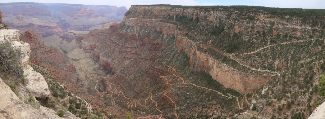
I did some distance training on the flats around my farm. I ran trails in the Marin Headlands that I love to run.
Most of my training was in the Mt. Vaca area. Primarily I would hike/run a loop: up Gates Canyon, along the
Blue Ridge gravel road, then down Mix Canyon, and finally along Pleasants Valley Road to the starting point.
One loop is 14.4miles and has over 2700 feet of elevation gain and fall. One loop took under 4 hours. After completing one loop I'd
continue to the ridge top again, roughly doubling the elevation gain. Eventually, I was able to do two loops in one go.


Up Gates Canyon to the highest point you see (left) and down Mix canyon (right) to the green flatlands.
Burned to mineral soil devastation illustrates how intense the huge LMU Complex fire was 7 months before.
My R2R2R Experiences
I got up before dawn and put on compression gear (including knee protection, in case I fall. Foreshadowing...) I had a quick bite, threw on my pack and was driven to the bus stop.
I had a bit of a wait for the bus to the trailhead.
Eventually, the bus departed and took a dozen of us to the TH.
I started descending the South Kaibab trail at 6:33am. Already late!

At the start. Temperature is 36F (2 C) Photo taken by a kind stranger
And I was off. I chatted with various folks on the way down.
Most were surprised to be passed by someone with a 70 year old body.
One lady was celebrating(??) her 55th birthday by hiking down to Phantom ranch and back.
A gentleman was unsure he could make it to the River and back in a day so he planned to take the
Tonto trail across to the Bright Angel. The paternal leader of an Italian family was non-stop
talking very loudly while fast walking with his silent wife and teenage son
I had trouble staying ahead of them (for peace and quiet) while also stopping to take pictures.
Ill see them again.
Some panoramic photos in the early morning light

Ooh Aah Point.

Below Ooh Aah Point.

Below Cedar Ridge. Note the 'ladder-like' trail,
the spaces between the jillion water bars are heavily gouged out by countless mules.

Below skeleton Point. Down, down, down.

Near the Tipoff, with a first view of the Black Bridge. Yes, the trail is as steep as it looks.
A trail runner blew past me below the Tip Off (4.4mi).
Just above the Black Bridge I traded favors with someone to take pictures of each other with our own cameras.
Silly me, this is the only photo I have showing me in the canyon!

Several hundred feet above the Colorado River and the River trail (way below and to the left of me).
I crossed at the Black Bridge at 9:30 after spending 15 minutes taking pictures and movies of it from various angles.
You enter the bridge (from the South) through a short tunnel.

Above the Black Bridge & Tunnel.

Above the Black Bridge & Tunnel.

A panoramic view of the Silver (left) and Black (right) Bridges.
Here is a
short movie
of the Colorado showing the Silver Bridge (just before the Black Bridge). (Warning: this .mp4 file is 116MB)

The Black Bridge tunnel.
Here is a
short movie
heading from the tunnel onto the Black Bridge. (Warning: this .mov file is 89MB)
 ..
..

A (rather poor) stereo view of the Black Bridge.

Another view of the Black Bridge.
Theres an Anasazi ruin nearby.Then a short walk to Phantom Ranch.

Interpretive sign at the ruins.
 ..
..

A stereo view of some ruins and the Black Bridge.

Phantom Ranch store.

A map of the Bright Angel Camp and Phantom Ranch area during daylight, courtesy of Kristen.
The temperature was pleasant, maybe 70F (21 C). I rested there a bit and considered buying a souvenir and maybe a drink but the line was long and I had far to go.
I ate a chewy bar, more electrolyte drink, and pressed on.
My plan was to run the lower, flatter parts and hike the steeper parts of the North Kaibab trail to the North Rim.
Theres about 9 miles of the lower North Kaibab that are runnable but that was difficult in practice
due to the many people also enjoying the scenery that morning.
It would take quite awhile to get past a knot of people, then Id run (at a 10 min/mile pace) until
bumping up against the next knot of people a few hundred feet up the trail.
Generally, the trail is much smoother than the South Kaibab
and due to the small gradient, most folks hiked at a brisk pace.
The first several miles are through 'The Box' which is a narrow stretch.

A view back towards The Box. Sharp-eyed viewers will notice two of the many water bars,
aka tripping hazards along the trail. I had another lesson in humility while running along the trail in
the far distance: I tripped and fell flat on my face. (sigh) Luckly, only my pride was injured!

Agave in full bloom.
After several miles the canyon widens.
About 5.5 miles (9.5 km) from Phantom Ranch along the North Kaibab trail I found the sign to bushwhack towards Ribbon falls.
The falls is visible from the North Kaibab trail at this point. To get there
one must stone-hop across Bright Angel creek, swollen with spring runoff.
Then one weaves through willows and rocks to the side canyon and more obstacles.

Ribbon falls is in a short box canyon.
The canyon quickly boxes up with the delicate spray of Ribbon Falls cascading through a chute and
onto a mound covered with bright, dark green moss.

That mound is >20 feet (>6 m) high
A rough path leads up and behind the falls, revealing some flowers and a spectacular view.

I am so glad I made this side trip. Ive travelled much of the Colorado Plateau back country and cannot recall anything like this sight. One of the prettier spots I've encountered in Canyon Country. Exquisite!
Here's a few more pictures of Ribbon falls.


Lovely... and while the temperature was maybe 79F (26 C) when I lingered, on a
hot day it would be cool!
Here is a
short movie
of Ribbon Falls showing the big mound. (Warning: this .mp4 file is 60MB) Can you find the lizard?
Here is a
short movie
from behind the falls. (Warning: this .mov file is 106MB)
After another chewy bar, electrolyte drink, and lots of pictures taking nearly an hour, I followed a different route back to the North Kaibab.
This route used to have a bridge over Bright Angel Creek, but that bridge is long gone.
The crux was a leap across a 2 meter wide stretch of concentrated flow just above the former bridge site.
It would be very unpleasant if not successfully leaped.
I thought about that a lot but found no alternative and lept across. In all a 1.5 mile side trip to experience cool Ribbon Falls.

Looking back at the jump. Doesn't look like much but you have no run-up and you leap from the small rock
to a downsloping rock.
One reason for not backtracking was to avoid what the Rangers call Asinine Hill which is a several hundred foot climb up from creek level, then right back down to creek level on the North Kaibab trail.
I made water stops at Cottonwood Camp (6.5 miles / 10.5 km from the North Rim) and at Manzanita Rest area
(5.1 miles / 8.2 km). Manzanita is where the trail starts climbing steeply. Lots of people at picnic tables in the
shade of a cottonwood tree. One must gain 3280 feet (1170 m) to reach the rim.

Looking downstream from the Manzanita rest stop, nicely shaded by a cottonwood tree. The trail's bridge
in the background.

Interpretive sign at Manzanita.
Above Manzanita, the trail leaves the Bright Angel canyon for a side canyon (Roaring Springs canyon) that is followed to the rim.
Not long after leaving Bright Angel canyon one can see the massive outflow of Roaring Spring across this smaller valley.

Looking across Roaring Springs canyon to the spring that gives the canyon its name. (This one spring supplies water
to *both* sides of Grand Canyon!) To the right, Bright Angel Canyon continues on.
I played hop scotch with more capable hikers as Id push ahead, theyd catch up when I stopped to take a photo.

Looking across Roaring Springs canyon. The trail follows an ascending bench (notch in shadow at far left,
and at the base of the higher red cliff in the middle distance at the left). The North rim is now visible! (The highest point in
this image, to the left, above a white cliff on the other side of the canyon.)
Just before Redwall Bridge the trail drops a hundred feet or more, crosses a short bridge, then climbs again.
Parts of this section follow ledges on cliffs with overhangs before reaching Supai Tunnel water stop.
North rim day trippers often stop here (1400 feet, 425 m below; 2 miles, 3.2 km from the top).
When I reached Supai rest area and began refilling my water bottles a big group of folks out for a commercial trail
ride decided that was the moment to head up the trail.
On the advice of some others waiting there, I waited about 45 minutes for those mules and horses
(and their dust, pee, and poop) to get well ahead of me. In hindsight, maybe I should have pressed on sooner as the odor
lingered even after the long wait.
While waiting I chatted with a pair of guys also doing an R2R2R that day
being less than half my age and better prepared. One had done it several times in the past; his buddy had not tried it before
and kept repeating: "This is the hardest thing I've ever done." They were nearly done,
having started on the North Rim that morning.
Me? I was not even half done

Shady fir forest. Nearing the top!
Here is a
short movie
from Kisten as I approach the North Rim. Kristen is giving encouragment. A bit of a slog! (Warning: this .mov file is 23MB)
I reached the North Rim (after the wait for a horse train) at about 4:30pm, 1,040 feet (316 m) higher than my starting point and 5750 feet (1750 m)
above the Colorado River.

Finally! I'm at the North Kaibab trail head. Leaning rather heavily on those poles! Tired? Me?
(Umm... yes!) Note the compression calf sleeves, the loose knee sleeves held up by compression shorts (the shorts not visible).
Well padded Hoka One One's (Stinson 6). Running pack and all kinds of sun protection!
I was pretty beat. However, seeing my friend Kristen waiting for me boosted my spirits. Being an internal medicine
doctor, I expected her to pull me off the trail.
But she understood my need for self punishment, er, I mean need to accomplish a massive goal and
the subject did not come up.
Instead we chatted about what Id experienced; she discussed her drive that morning from the South to the North rim.

Big smile. I'm 'holding up' the sign (OK, not.) I'm half-way! Only...! Yikes...!
These 'selfies' are courtesy of Kristen.
Mostly I ate, elevated my feet, ate, tried to massage stinging (lactic acid?) out of my aching legs and to ward off cramping, ate some more, and had a toilet visit. Did I mention eat? I was craving calories. After about 90 minutes, I headed back down the North Kaibab, fortified with another shot of caffeine and sugar (from a 16 oz / 0.47 li Classic Coke).
It was getting near sunset so I headed down with some urgency.
Kristen shot another
short movie
of me heading back down -- refreshed and moving more briskly than when I came up. (Warning: this .mov file is 33MB)
After a mile I passed that Italian family a little below Coconino Overlook
very quiet now, the man silenced by exhaustion, 800 feet (243 m) below the end of their R2R.
I surprised a Ranger on the trail but she didnt try to stop me from heading down and into the night. (Thank you caffeine.)


Above the redwall bridge (left) and below the bridge showing the redwall trail hugging the clif-face (right).
Earlier on this page I show a picture looking the
other direction up towards this vantage point in the right picture. The nearly full moon is up. The Sun is setting!
I only made a couple of stops: near the Redwall Bridge and at Manzanita (another chewy bar, more electrolyte drink). Nobody there. Vibrant with chattering folks when I first came through. Now in dusk, my aloneness was disquieting.
Below Manzanita I ran some of the North Kaibab. I had a small desire to join the folks I passed who were relaxing at Cottonwood camp. I ran some more. The last person I saw was at the top of 'Asinine Hill'. (As I approached, I watched him throw his pack down. In disgust? I would not blame him!) I ran some more but I was far behind my expected schedule and as I reached The Box it became too dark to run safely, even with a headlamp. One issue was the bats.
I like seeing bats in Canyon Country: it means the mosquitos are not flying. However, my headlamp would attract flying insects and thus a bat would suddenly flap into view to snatch their prey, mere inches from my face! Unnerving if also a bit fun. Only once of the dozens of times this happened did I feel even the slightest brush of a bat wing.
I reached Phantom Ranch at 9pm. After 3 hours I was 5740 feet (1750 m) below and 13.7 miles (22 km) from the
North Rim trailhead. I spent a half hour there eating another chewy bar and
drinking and making more caffeinated electrolyte.
From there I crossed the Silver Bridge
and followed the River trail until I could connect with the Bright Angel trail.
The moon was full and I strode solely in moonlight at times to save the batteries on my headlamp.

Looking downstream from the Silver bridge, lit only by moonlight, starlight, and two airplanes.
I was definitely tiring and in the darkness and moonlight eventually reached Indian Garden Rest stop.
I was only 5 miles (8.1 km) from Phantom Ranch, though 1400 feet (425 m) higher. The River trail had some sandy
bits and rough rock; the lower Bright Angel had several stream crossings (difficult to pick a path in the dark).
At this point, 11:30pm, I hit the wall something I recognized from my first marathon.
Nauseous, unable to get comfortable in any position: standing, sitting, laying down,
I spent a half hour rocking and moaning at the water station. Massaging and finally recovering.
I was still 4.5 miles (7.2 km) from and 3,040 feet (925 m) below the top.

Here's a view during daylight, courtesy of Kristen from 2 days before. Remember that wind I mentioned?
Yes, wind ripped up the shade cloth there. The fountain faucet, spraying water is beyond that large dark rock.

A map of the Indian Garden area during daylight, courtesy of Kristen. I rested at the water glass symbol.
Nobody was going hike the remainder for me, so I choked down my last chewy bar,
made up my last 3 bottles of caffeinated electrolytes and dragged myself back onto the trail.
A thousand or so feet above me I could see a pair of lights moving up the switchbacks.
Whhaaaat? Some others are silly enough to be on this trail at midnight!
I kept at it until reaching 3 mile Resthouse, 2120 feet of elevation left (4.8 km; 645 m).

Here's a view during daylight of the spur path to 3-Mile Resthouse, courtesy of Kristen from 2 days before.
I finished one of the electrolyte bottles, started another, and rested a bit.
I pressed on towards 1.5 mile house. I now noticed there were 3 lights on the trail, one might be coming down?
About a mile further, I met Kristen coming down to see what the heck is the hold up!?
OK, it was nice to have a little company in my misery.
We hiked together with me stopping every few minutes to clear my nostrils, I was congested due to the cold air but thankfully
there was no wind. The temperature was around 45 F (7 C).
A little ways further we passed the pair of folks whose lights Id watched for two hours.
An old guy and his younger female companion hmm, I detect a pattern here.
We wished them well and passed them.
It was chilly (now around 40F, 4.5 C) nearing the top. I blew past 1.5 mile Resthouse, 1120 feet elevation gain left (2.4 km; 340 m).
Finally, we reached the top at 2:36 am. DONE!

Finally! ...... I can sit! ... :-D
Later that morning, after 4 hours sleep, we left Grand Canyon driving towards home.
Some Final Thoughts
My R2R2R journey was a life-changing experience. While there are certainly things I would do differently,
overall, I am satisfied with my effort. Perhaps the biggest change I'd make is to bring more light-weight, high-calorie,
protein-rich food, perhaps protein powder. (There are only 100 calories in a chewy bar.)
Would I recommend the R2R2R to others? Yes, but with
qualifications: you need to be more fit than you think; you need some luck and flexibiity regarding the weather; and
maybe don't try it with a 70 year old body! (The FKT at this writing is just under 6 hours,
but if you follow the NPS Grand Canyon backcountry hiking guide, you should allow
5-6 days for this journey -- just sayin'.) If you do try it, be mindful of the time, conditions, and
please stay within your limits. Finally, take time to enjoy
the experience.
Cheers!
- Back to my homepage.