ATM 112
Weather Forecasting Practice

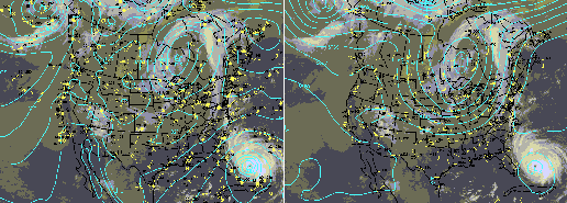
Hurricane Floyd, 12 GMT 14 September 1999
(2 credits, P/NP)
CRN: 69907
Page Last modified: 23 September 2002
SPECIAL NOTICE:
Initial meeting is a planning meeting: 1 October, 4:40 pm,
rm 124 Hoagland. If you are interested, please attend! At this meeting
we intend to find a schedule that avoids scheduling conflicts
with other courses.
We shall also discuss the course duties, assign tasks if possible,
and gear up to make our first forecast on Thursday.
Course Summary:
This course provides experience making and verifying weather forecasts.
ATM 110 is the only prerequesite.
Course Goals:
- To gain practical experience combining weather maps, models, and theory.
- To gain experience in how to interpret imperfect guidance.
- To gain familiarity with tools available to weather forecasters.
- To understand the atmosphere a bit better
Instructor:
Prof. R. Grotjahn
rm 231 Hoagland Hall, Phone: 752-2246, E-mail: grotjahn'at'ucdavis.edu
Meetings:
Course meeting times & location:
- discussion: 4:10-5:00 pm T,Th; rm 124 Hoagland Hall
- lab: 5:00-5:30 pm T,Th; rm 124 Hoagland Hall
Initial meeting is a planning meeting: 1 October, 4:40 pm,
rm 124 Hoagland.
Course Description:
- Students work together to prepare 12-60 hr forecasts for three locations: Davis,
the Pacific
coast (SFO), and the mountains (BLU).
- Prior to the class meetings students gather the necessary
maps, charts, and textual data. Including:
- AVN (or MRF) and NGM MOS products (on board)
- NWS forecasts (on board)
- current conditions at the forecast stations
- persistence values (last night's low, estimates of others)
- The past, current, and forecast information is reviewed.
- The previous forecast by the class is reviewed with the intent of identifying
what (if anything) went wrong and why.
- The prior forecast and its error for us, the relevant NWS office,
and persistence is written on the board
- The gross error (Brier score) and bias are tabulated (see below)
for the whole course.
- The forecast products are then discussed by the group and everyone
participates.
- Maps for the AVN are reviewed first (since the preferred MOS is
used later, modifications to the MOS guidance we make can be drawn
from differences we expect between the AVN and the model guidance
we prefer.
- It is useful to track a gross difference: thickness over KSAC
at the forecast times from each model consulted
- Typical order of maps:
- Satellite loop -- (McIdas) to see current patterns and
their recent trend(s)
- 500mb with vorticity -- to see upper level flow, PVA & NVA,
& large scale features
- SLP/thickness -- to see low level flow, WAA & CAA,
& tracks predicted of lows.
- Precipitation -- (if not already on a map above) to see
coverage & amounts forecast.
- Other levels: 850mb for flows & T in Sierra mountains
- The specific forecast values are decided upon by the group.
- The final product is typed up during the lab session and placed
on a web page for all to see.
Please see the instructor or check out the following web page for more
details about the course procedures
.
NOTES.
- This course is an excellent complement to the material given in ATM 111.
- This course is offered during fall quarter.
- A notebook on how to forecast is available in the bookstore and is
consulted as is useful.
- The course may be repeated for credit.
Printed Materials:
Textbook used: None
Photocopied materials in the bookstore (see links below):
Grading Policies
grading: P/NP. A passing grade is based on completion of the tasks. These
tasks include the web page preparation
and the oral presentations. Failure to meet a responsibility may lead to a No Pass grade.
The forecasts themselves are not graded.
Miscellaneous:
Busted forecasts
- The December 2000 big freeze that wasn't