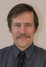
ichard Grotjahn
| |
Richard Grotjahn
Professor of Climate Dynamics, Emeritus
Past President of ICDM
|
This File is ocassionally Under Construction /be users directory Last update: 11 March 2022.
| I was born
in Seattle. I received a B.S. in Atmospheric Science from the University of
Washington. I completed M.S. and Ph. D. degrees at Florida State University .
I was a postdoctoral scholar at NCAR and at CIRES before moving to Davis in January 1982. I've had four sabbaticals: BMRC (Melbourne Australia), twice at NCAR, and at LASG (Beijing China). My scientific work bridges these broad disciplinary categories:
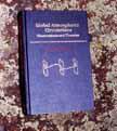
I seek to understand whatever problem I am studying from multiple directions. My areas of focus have been frontal cyclones, subtropical highs, the atmosphere's global scale circulations, climate change, and weather predition. In the early 1990's I wrote a comprehensive book on the general circulation; I have signed a contract to thoroughly revise and update the book for a new publisher. I've also edited two journal special editions and had other articles on the subject. I wrote the chapter on extreme weather in the popular-science book 'Encyclopedia of Weather and Climate Change. I am currently co-editing (with J Li, R Swinbank, and H Volkert) a technical book on high-impact weather and extreme climate for Cambridge Univ. Press. |
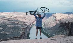
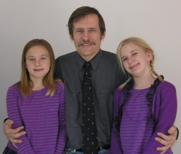
In pure theoretical dynamics, I have studied localized systems (instead of wavetrains). I approach the problem in an unusual way, by tempering the theoretical work with corresponding observational analysis. I am developing a new research line interrogating how extreme weather-creating patterns develop. I am past Secretary and presently Past President of the International Commission on Dynamical Meteorology ( ICDM ) a commission of the International Association of Meteorology and Atmospheric Sciences. ( IAMAS ) I am also a member of the CNRCWP scientific advisory board, led the US CLIVAR working group on Extremes, and so forth. My official departmental web page is here. More personal information can be found here. I taught severe and unusual weather, computer methods, general circulation, weather forecasting and synoptic meteorology, advanced dynamics, and 8 other subjects as needed by the group. 9 graduate students (4 women, 5 men) completed their degrees under my guidance. (2 more are in progress) Permanent job options specifically in dynamics are quite limited, but general computer and modeling skills remain broadly employable. (Atmospheric Sciences has better employment prospects than most sciences.) Beyond my regular faculty duties, I own a small organic farm 4 miles from Davis. Our main crop is pistachios. Recently, we installed a 4kW solar PV system that provides about 75% of the electrical usage in the house and rental unit. My twin daughters, Anna & Karen, born in April 1997, keep my wife and me very busy. I lived in Australia for a year and I have visited 6 continents ( I've not yet visited Antarctica). |
| Research Projects: |
|
My current research includes:
|
| Miscellaneous Projects | |
 |
 |
|
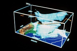
General circulation of the atmosphere projects.
Global Atmospheric Circulations |
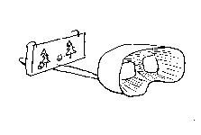
stereo homepage |
| General circulation of the atmosphere projects
and an old site for my book: Global Atmospheric Circulations |
Numerous images and techniques for viewing and making stereo images with a camera or using computer graphics. |
 Family
 |
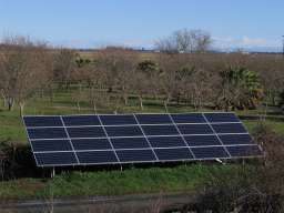 Farm (solar since 2007) Farm (solar since 2007) |
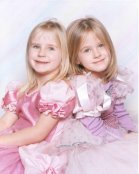
| Anna & Karen my twin daughters | Rich Fields Farm about my farm. |
| Slide show Image Magnifier (tests) | pistachios production |
| Teaching related links: Some of my course web pages: | |
| ATM 10 | Severe and Unusual Weather. |
| ATM 98 | Practical Skills for a Career in Physical Science. |
| ATM 111 | Weather Analysis and Forecasting. |
| ATM 112 | Weather Forecasting Practice. |
| ATM 121A | Introduction to Atmospheric Dynamics. |
| ATM 150 | Introduction to Computer Methods. |
| ATM 240 | General Circulation of the Atmosphere. |
| Administration work: |
| LAWR Homepage LAWR Information Technology committee web site. UCAR members meeting Oct. 1999 |
| University of California information: | |
| Benefits: | |
| Retirement and savings | UC systemwide main entry |
| UCD Benefits | main entry |
| Rates for the savings plans | main entry Page maintained by UCD |
| Library information and searching: | |
|
UCDavis Electronic Journals
Also CDL Library online journals |
Defunct Calif. Digital Lib lists -- select Phys. Sci. + browse |
| AMS online journal search | not a UCD or UC link |
| UCD Library | main entry |
| MELVYL | main entry at UCOP |
| UCD Library | catalogs and databases at UCD |
| UCD office of research: | |
| main entry forms | |
|
travel & faculty research awards travel awards status |
Committee on Research |
| sponsored programs | Grant Preparation |
| miscellaneous: | |
| UCD accounts & passwords | |
| UCD site license software Norton | lists of vendors and ordering info |
| central storehouse | |
| Policy & procedure manuals | |
| Sabbatical rules from UCOP | APM 740 |
| web-based UCD manuals | including research travel |
| Application for research travel | form, in several formats |
| Various travel forms | from accounting & finance |
| UCD travel insurance | information & forms |
| Graduate Studies/Division: | GARD link | Grad Applicant Review Database (GARD) |
 Hotlist
 Atmospheric Science Links
| Local Weather Products: | |
| student-run local forecast products | |
| California list nationwide list | text information organized by state DEFUNCT 12/03 |
| Sacramento Valley Extraordinary Weather Forecasting using Composites: | |
| Hard Freeze conditions | Long Duration Fog conditions |
| Heat Wave conditions | End of Heat Wave conditions |
| Heavy Rain conditions | Technical Reports:
.pdf of methodology
and .pdf of figures and other appendices |
| NWS offices: | |
| current conditions various models radars Main Entry | SACRAMENTO NWS |
| Various Nationwide MAPS | NWS maps: radar, precip. accumulation, flooding, watch/warnings, Fronts, AQ etc. |
| main entry forecast maps & text. | MONTEREY NWS |
| main entry point | RENO NWS |
| Current radar imagery | |
| NWS Dixon Radar | Sac NWSFO site can navigate to adjacent radars, do loops, etc. |
| Sac
(DAX) larger view national
Sac (DAX) Doppler |
courtesy of Intellicast. Links keep changing but it should forward you |
| national loop | produced at PSU |
| national | (in WXP format) produced at SFSU |
| Analysis products: | |
| N. Pac. Satellite-500mb overlay N. Pac. Satellite-sfc P overlay general entry | SAN FRANCISCO STATE UNIV |
| anim still | PSU Sat overlays |
| SKEW T and profiler | RAP at NCAR |
| DIFAX products | at U. Wyoming, choose 1/2 gif size |
| DIFAX products | NWS Charts on the net, telecom ops cntr |
| DIFAX products | (WEFAX) from NWS iwin server |
| METAR products | interactive map at FSL |
| Forecast & Analysis Products sites: | |
| General entry point | Unisys site |
| General entry point | PSU - eMap-Wall |
| main entry point | NOGAPS -- NGP & AVN/MRF |
| main entry point | NORAPS -- limited area model |
| satellite products | NRL |
| general list NAM forecasts | IGES at UNIV. MARYLAND |
| forecast models Meso-eta output | UNIV. OF UTAH -- regional, but many models |
| AVN & ETA model comparisons other products | CDC MAPROOM . . .mdl comparisons defunct |
| NCEP model data runs | EMC -- Environmental Modeling Center |
| MM5 forecast model runs | UNIV. OF WASHINGTON -- try the loops |
| general entry | UNIV. HAWAII -- tropical wx, satellite & fcst loops |
| NOAA Air Resources Lab site | NOAA Air Resources Lab "Ready" site, build custom maps |
| ETA, RUC, and MRF forecast
models main entry point |
RAP at NCAR -- branches to other types of data and charts |
|
Analyses
Forecasts
Observations RUC model MAPS |
FSL Weather products -- branches to model plots, soundings, etc. |
| main entry model products | Ohio State Univ. |
| main entry skew-T ln-P Under const. animated satellite images | U. Illinois Weather Visualizer |
| MOS and forecast meteograms products: | |
| MRF & AVN MOS | Univ. of WYOMING -- pick region and model |
| MRF MOS for California general entry point | NOAA site -- also has MRF MOS for other states |
| MOS general entry point | NWS Met Dvlpmt Lab -- Eta, AVN, MRF, NGM & other MOS |
| eMap-Wall of MOS maps | produced at PSU |
| Eta Forecast meteograms | at nearest mdl grid pt to station. Experimental NCEP product (10/02) |
| NOAA Air Resources Lab site | NOAA Air Resources Lab "Ready" site |
| Sacramento Eta model data Sacramento AVN model data General list of cities site | IGES/U. Maryland |
| Medium to Seasonal Forecasts: | |
| main entry point | USA Today general links |
| COLA | short term outlooks |
| main entry ECMWF model bias ECMWF model input sources | Various ECMWF products |
| Seasonal forecasts CDC alt site | NOAA Official sites |
| seasonal products | IRI U. Columbia |
| Exper. Long-lead Fcst Blltn | IGES |
| Predictions & links | ECPC - UCSD, Scripps |
| Miscellaneous Products: | |
| main entry point | NCEP Ensemble Products |
| General entry | ECMWF: 'free access' charts; pick area and overview (valid time) |
| radar main entry | NWS internet weather source |
| SSEC satellite images | U. Wisconsin: global; specialty images |
| defunct entry page | defunct |
****************** links repaired 01/04 **********
| Isentropic Charts | |
| P RH PV and winds | class AOS 453 at Univ. Wisconsin |
| constant theta | Florida State Univ -- at RAOBs |
| Texas A&M Univ | |
| Archives of weather information | |
| Text data: | |
| get/view current fcsts and recent obs | Selecting "climatic data" obtains the previous day's max/min T and precip |
|
24-hour total CONUS/Canada map
hourly precip Hourly datasets |
NWS hi-res CONUS/Canada up to 4 days back
NCEI data from 1951 Other datasets at NOAA |
| STP data RTP #1 RTP #2 | Hi/Lo/Precip for No Calif. recent days |
| No. Calif. Climate Reports | 1/day for recent years |
| Satellite Data | |
| GOES Satellite imagery satellite data entry | from NCDC -- several years worth, GOES 7, 8, and 9 |
| Satellite images | NOAA has from various satellites including GOES, GMS, and Meteosat |
| Satellite overlays | SFSU has overlays of 300, 500, SLP contours on GOES E and W |
| GOES Satellite images | NRL site. overlays and animations for N.E. Pacific and other regions |
| Forecast Model Output | |
| main entry point | NOGAPS -- back 3 days (2 runs/da) |
| general forecast model entry site. | Univ. Utah: ETA (7 days back), MRF (10 days back), NGM (7 days back) |
| MM5 forecast model images | Univ. Washington |
| Weather Maps | |
| NOAA Sfc map web site | Archives begin 1871-1968, 1968-2002, 2002-present. |
| NOAA recent SURFACE maps site, NOAA recent UPPER AIR maps site | Recent Archives 2002-present for sfc, 19981130-present for upper air |
| Purdue's WXP | Period covered: 1/96 - 2/99 ... |
| COVIS @ U. Illinois | Skew-T charts up to 2 days back |
| FSL - NOAA Site | data back into 1997. ASCII text files and perhaps graphs |
| NOAA Air Resources Lab site | Some maps go back several years |
| NOAA Climate Data | |
| NOAA web sites, (and main page) | CONUS Sfc: Tmean, Tmax, Tmin, Precip Trends begin 1988-2017, 1895-2017. Other links, such as extremes |
| Other | |
| NCEP see also CDAS | Reanalysis data main page at CDC |
| to ftp Reanalysis data | from CDC.
cd Datasets To obtain daily data for SLP (and other variables): cd ncep.reanalysis.dailyavgs To obtain monthly derived data for SLP (and other variables): cd ncep.reanalysis.derived To obtain OLR data: cd interp_OLR To obtain SST data: cd reynolds_sst |
| UCAR/Unidata general entry point for NetCDF (e.g. choose 'Documentation') | where it originated |
| NetCDF User information | for FORTRAN at GitHub |
| NetCDF User's Guide | more on NetCDF from WhoIsHostingThis? |
| NOAA Ferret entry point | includes User Guide and Tutorial |
| NCEP see also CDAS | Reanalysis data from wwb (Wesley E.) |
| CDAS. ncep reanal data | daily averages and monthly averages |
| get/view climate data CLIMVIS surface station text observations | NCDC -- CLIMVIS draws maps. Other link has text data files (very large) |
| Commercial weather services | |
| general
entry point Sacramento
forecast San Francisco forecast Tahoe forecast |
Intellicast products |
| California list | Yahoo |
| California list | USA today |
| main entry (enter cit,state or zip code) | AccuWeather: |
| California list of forecasts. | CNN: |
| Search tools: | |
| Alta Vista | Lycos |
| Yahoo Yahoo string search engines site | google search engine site |
| Magellan | Dogpile search |
| News sources: | |
| CNN main SI entry ESPN | CNN, SI, and ESPN |
| main entry weather entry | USA Today |
| audio files official main entry | NPR |
| Newspapers: | |
| Davis Enterprise | Sacramento Bee |
| Humor: | |
| Sacramento Bee "Smile" entry | Sacramento Comic Press main entry |
| main entry email | Netscape - AOL |
| Shopping: | |
| BestBookBuys | compares > 2 dozen online merchants for book prices |
| computer shopper | compares prices at many computer equipment suppliers |
| Lehman's online | Electric & non-electric products for self-sufficient living. |
Miscellaneous:
| Computing-related Sites: | |
| main entry | NCAR Sci Comp Div |
| main entry | NCAR Clim. Global Dyn. |
| GrADS site general info | |
Go to my section
of the faculty page.
return to atmospheric science group home page.
You can send e-mail to me at my UCD account using:
Or:
If that fails...
You could also try to send e-mail to me at my business acount using
Graphical information about
accesses to this homepage is available.
Text information about accesses to
this homepage is also available.
STORAGE:
A list of favorite internet addresses (just for starters!)
Sacramento (SMF) 24 hr
Meteorogram
An alternative can sometimes be obtained from UCSD at: this location -- (it
might not be updated.) 24 hr Meteorogram (courtesy of UCSD)
Travis AFB (SUU) 24 hr
Meteorogram
Oakland Skew-T chart
temperature contours for
California
pressure contours for CA
PURDUE UNIV: formerly the products displayed by the Purdue Univ. WXP server
Here is the location of Purdue's earth and
atmospheric sciences department.
Past
Projects:| Past Project links: (note some may be broken) | |
| Some of my research projects and output | Misc. projects with my students: |
| my cgi Programs
(files executable over the web) Misc. .gif Movies
Dyanmics and Instability research links This path includes the paper on the instability of a local structure in directory "Local". |
Cris Castello's .gifs & .gif
Movies Cris Castello's radial .gifs & .gif Movies |